


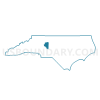
Voting District 08, Davidson County, North Carolina
About
Outline

Summary
| Unique Area Identifier | 639879 |
| Name | Voting District 08 |
| County | Davidson County |
| State | North Carolina |
| Area (square miles) | 3.51 |
| Land Area (square miles) | 3.51 |
| Water Area (square miles) | 0.00 |
| % of Land Area | 100.00 |
| % of Water Area | 0.00 |
| Latitude of the Internal Point | 35.79970430 |
| Longtitude of the Internal Point | -80.20971140 |
Maps


Graphs
Select a template below for downloading or customizing gragh for Voting District 08, Davidson County, North Carolina


Neighbors
Neighoring Voting District (by Name) Neighboring Voting District on the Map
- Voting District 20, Davidson County, NC
- Voting District 40, Davidson County, NC
- Voting District 52, Davidson County, NC
Top 10 Neighboring County Subdivision (by Population) Neighboring County Subdivision on the Map
- Lexington township, Davidson County, NC (30,851)
- Conrad Hill township, Davidson County, NC (9,401)
- Cotton Grove township, Davidson County, NC (9,066)
- Silver Hill township, Davidson County, NC (6,164)
Top 10 Neighboring Place (by Population) Neighboring Place on the Map
Top 10 Neighboring Unified School District (by Population) Neighboring Unified School District on the Map
Top 10 Neighboring State Legislative District Lower Chamber (by Population) Neighboring State Legislative District Lower Chamber on the Map
Top 10 Neighboring State Legislative District Upper Chamber (by Population) Neighboring State Legislative District Upper Chamber on the Map
Top 10 Neighboring 111th Congressional District (by Population) Neighboring 111th Congressional District on the Map
Top 10 Neighboring Census Tract (by Population) Neighboring Census Tract on the Map
- Census Tract 618.02, Davidson County, NC (6,740)
- Census Tract 619.01, Davidson County, NC (6,301)
- Census Tract 615, Davidson County, NC (6,214)
- Census Tract 619.02, Davidson County, NC (5,308)
- Census Tract 614, Davidson County, NC (3,398)